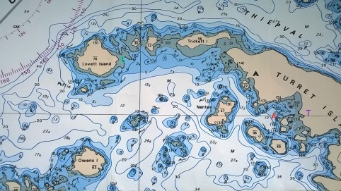

This is the chart of the area we are in. It is a Canadian Chart so the depths are in meters. the white area is deeper water. Blue is shallower water and tan is dry land. The asterics and plus signs represent rocks.
I have added a red A where Gypsy anchored. The green B is where we landed the dinghy to go beachcombing. It is about a mile from A to B. The purple T is where the big tree is.
